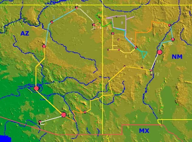
The colors change for each day and the legs are identified by the Day number. This is a clickable map. The cities/towns will return information or writings about the cities. The trip legs are also clickable. However, some region overlap. Please be kind. While I have tried to separate the overlapping region, it would be easier to choose a part of the trip leg that is not confused. These areas will take you to the pages describing that portion of the trip.
See our map and guide reference section for trail maps and other useful information available from Maps.com.
A page is provided which organizes the best satellite imagery of this area that I have been able to find.
Another map with the major
geographical features soon to be identified is also available.
This map was produced by Ray Sterner, Johns Hopkins University Applied
Physics Laboratory. You may read a
page describing
these maps.
You may also browse the U.S.
from this server at Texas A & M.
